|
Underwater caves
in Quintana Roo are often surveyed to meet the needs of the
exploration teams. Many of these cave surveys create a fairly accurate,
yet simple line plot. Line plots, or "stick maps" are valuable tools for
trained cave divers and speleologists. These plots fail to clearly
communicate basic aquifer and cave
characteristics to inexperienced cave plot users. Plots of this type can
be used to convey misleading
information about the aquifer to a casual user. Conduit shape, room dimensions,
aquifer details, anthropological sites, openings to the jungle surface,
connections to dry cave sumps, and important speleological details
are simply not documented through "stick maps".
Sensitive information,
such as significant anthropological objects or cave entrances on private
properties should not be shared with the general public. Yet regional
planners, government officials, and the public require reasonable,
unbiased information to make educated decisions in how best to plan for
future interactions with the aquifer and karst region of Quintana Roo.
As responsible explorers we must find a responsible middle
ground to describe the known areas of a sensitive aquifer.
Line or survey plots for
caves in this region are made available to State, Federal, and
local agencies since 1995. These surveys were superimposed on topographic maps,
aerial photographs, and eventually on Google Maps. We find and label sensitive cave areas to guide future local and regional planning. Regional
planners in Quintana Roo are not cave explorers or speleologists. State
and Federal politicians cannot be expected to be knowledgeable
hydrologists. Without the advice and close support of unbiased
speleologists local planners and politicians will have difficulties in interpreting
token data and information presented by crude line plots.
Unfortunately, speleological experts
may impart a casual interpretation of aquifer
and cave characteristics to meet
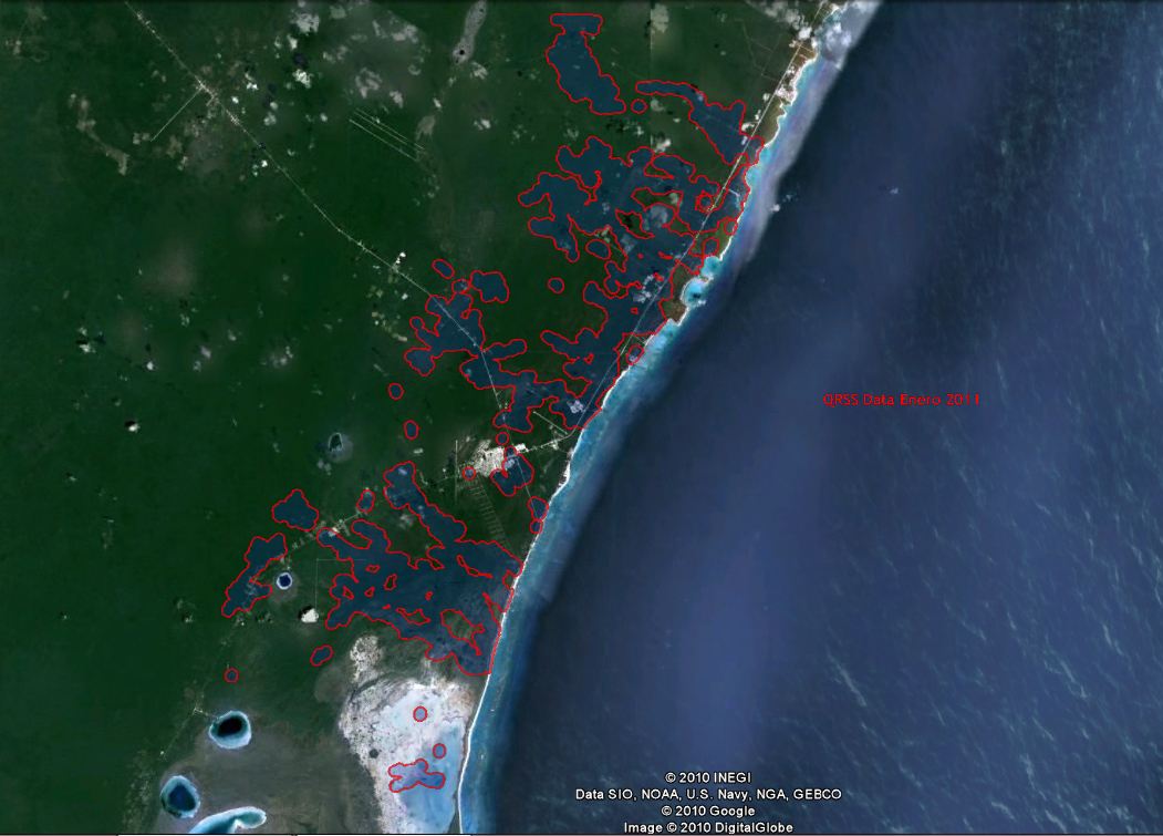
their own agenda. QRSS would like to present a different view of cave zones, or cave "footprint"
view for the public. We compute these images from real-time cave survey
data. The cave data is buffered by
250 meters to include smaller passage that cave divers cannot report in their line plots. Scientific literature appears to support a 300 meter buffer to
a central cave line plot.
QRSS supports
responsible regional planning that conserves both regional aquifer purity
and terrestrial ecologies. These are easily compromised by irresponsible
or mismanaged actions. Requests for our collaboration with regional
planning and cave documentation doubled since 2010. QRSS
collaborates with all parties interested in preserving the caves and fresh
water aquifer of Quintana Roo.
|